Friday, August 28, 2015

International Year of Soils: 2015

Environmental & Science Education
Edward Hessler

LOGO IYS zh
By 联合国粮食及农业组织 (http://www.fao.org/soils-2015/logo-guidelines/zh/)
[CC BY 4.0 (http://creativecommons.org/licenses/by/4.0)],
via Wikimedia Commons
The 68th General Assembly declared 2015 the International Year of Soils. (IYS)

According to the UN soil is "humanity's silent ally."

Here is one more resource from the Food and Agricultural Organization.

There is a citizen science soils program about which you may learn more here.

The IYS kicked off in December 2014 so I'm more than a little late! My hope is that you know about it already.

Tuesday, August 25, 2015

"A Singularly Unfeminine Profession"

Environmental & Science Education
Edward Hessler
Image from Amazon.com
Over at "Not Even Wrong," Peter Woit, a mathematical physicist at Columbia University, has a great post on a new book by Mary K. Gaillard about her life as a high-energy physics (HEP) phenomenologist.  I had not heard of her but Woit writes with authority and insight about the importance and significance of her work. Dr. Gaillard was the first female physics professor at the University of California-Berkeley.

There is another reason to know about the book and is the main reason I call attention to it. According to Woit,

A major theme of the book is that of how her gender has affected her career, including more discussion of the details of her employment and job offers than would be usual in a book of this kind. It’s a complex story, with the details of it well worth paying attention to for anyone interested in the problems women encounter in science.

Woit also links readers to an enthusiastic review in Nature, one of the most important journals of science in the world. I copy that link here.

The phrase not even wrong was coined by the theoretical physicist Wolfgang Pauli who had little time for fools. As the Wiki entry softly notes, the term is "considered derogatory."  Woit has been a long term critic of string theory and you may read about his views and criticism here.

Monday, August 24, 2015

On Becoming a Monarch

Environmental & Science Education
Sustainability
Edward Hessler

A new paper from the Oberhauser Lab at the University of Minnesota-Twin Cities, reports on an analysis of 18 years of data from the Monarch Larva Monitoring Project (MLMP).

Two factors have been implicated in the decline of the eastern North American population of the monarch butterfly (Danaus plexippus).  One is an area effect, the decreasing availability of overwintering habitat occupied by adults. The other is also an area effect. There is less and less breeding habitat available.

Carrie Benham, MLMP
In this paper, the authors consider an alternative explanation: declining survival.  It makes use of a trove of data and laboratory work.

The goals of this research on monarchs were twofold: 1) to "estimate immature survival over broad spatial and temporal scales, and to determine what local- and landscape-level site characteristics, as well as spatial and temporal factors, are correlated with egg and larval survival" and 2) to "determine if there are temporal trends in monarch survival, and thus if immature survival rates could be drivers of the observed decline in monarch numbers."

I highlight three key findings but add a caveat.  These short summaries are not without their dangers. So, check the paper for yourself to explore the richness of the research findings. This is where the science is found--in the details--as well as the methods used.

Variation in the survival of immature monarchs is large.  There are two implications. One is for modeling monarch populations and the other is on taking monarch conservation actions.  Neither has included immature monarch mortality.

There was a tendency for survival to be higher in areas with more milkweed (Asclepias syriaca) plants.

Finally, because the research was based on a collection of long-term data, the researchers were able to make an estimate of how many milkweed plants it takes to make a monarch butterfly. This is an adult which will become a fall migrant. Thanks to this work there is now a number...an estimate...a starting point...a minimum for monarch butterfly conservationists to use in planning and management.

Barbara Powers, MLMP
Make a guess and then check the paper for the answer. There are two places it is mentioned, at the end of the abstract and near the end of the discussion of the results.  I was surprised and it made me consider in a much more concrete way what it takes to produce a monarch and then millions and millions of them.

One of the advantages of having a long-term data set is in determining whether there is sufficient data or whether there are holes and, if so, where they are. This study revealed some data gaps if the journey monarch butterflies make to Mexico in the fall (4000 km, a distance that deserves a "Wow!" And some wonder, too.) is to be understood and appropriate conservation actions taken.  The mid-latitudes and the south-east did not provide enough data for what the authors refer to as a "robust analysis."

This study is a wonderful example of the value of long-term monitoring projects done by volunteers. Karen Oberhauser has referred to citizen scientists as an "army for conservation." The need for such information cannot be underestimated as this paper shows. 

h/t to the Minnesota Academy of Science for calling attention to this paper.

P. S. Daniel Ashe, Director of the United States Fish and Wildlife Service (USFWS) visited the Minnesota Valley National Wildlife Refuge, August 20.  He was interviewed by Tom Weber, Minnesota Public Radio where he talked about the just announced 20 million dollar plan to protect the monarch.

During the interview, Ashe characterized the "midwest in the United States as Ground Zero" for monarchs. One way to think about this area is as the corn belt. This is the area where monarch conservation will be won or lost. It produces some 50 percent of the monarchs which migrate to Mexico.

Thursday, August 20, 2015

Inuvik to Tuktoyaktuk

WATER & WATERSHEDS
by Taylor Fredin and Nick Peterson

Deh Cho Canoe Expedition


Taylor Fredin and Nick Peterson are paddling 1,500 miles across the Mackenzie River watershed.  The canoe trip will take them down the Slave River, around the South Shore of Great Slave Lake, and down Canada’s longest river: the Mackenzie. They will be exploring northern culture and environmental issues in and around the watershed.

A very chilly selfie

Inuvik to Tuktoyaktuk: August 2 - August 7


Nick and I left Inuvik on a rainy, cold morning. The Mackenzie River
Delta has hundreds of lakes and river channels that had the potential to make navigation difficult. Fortunately, we were able to follow barge markers most of the way from Inuvik to the Arctic Ocean.

The East Channel of the Mackenzie River delta is home to countless migratory birds, large caribou and reindeer herds, and many endemic species of fish.

During the summer, however, the east channel serves as the main waterway between Tuktoyuktuk, on the arctic ocean, and Inuvik. We saw barges, motorboats and even a construction crew with a large
crane.

A large barge near the ocean

To our surprise, the delta seemed less "wild" than the rest of the Mackenzie River.

Breakfast in the rain

Abundant grizzly bear tracks, cold weather, and rain made for an exciting and challenging trip through the delta, despite the presence of human development.

A very damp  morning

The beautiful Caribou Hills lined the east shore of the east channel, hiding the treeless tundra beyond.

The Caribou Hills
Occasional glimpses between the hills were exciting. The trees got progressively smaller as we paddled closer to the ocean.

Finally, three stunted spruce marked the northern limit of trees. Beyond this point a green blanket of moss, lichen, berries, and small shrubs hid the permafrost. Barren lands did not seem to be an appropriate description of this lush area. Perhaps a winter visit would offer a new perspective.

Camping above the treeline
We reached the Arctic Ocean the night of August 4th and were treated to a brilliant pink sunset. The next morning, we planned to paddle all the way to Tuktoyaktuk!

A beautiful sunset on the Arctic Ocean
After 5 miles on the ocean, a storm began to pick up. We got off the water as it started to downpour and lightning.

The people using a nearby whaling camp allowed us to stay in an empty cabin.

The camp used by Inuvialuit people from Tuk and Inuvik. Here they hunt beluga whales at the end of June and early July and catch herring in August. This meat is a main source of food for many people in the area. The storm raged on for 36 hours.

We were happy to have a warm, dry place to wait for calm water.

Nick tying down our canoe as the wind increased.
On the morning of August 7th Nick and I woke up at 4:00 am to a calm ocean. Excited, we loaded the canoe and set off for Tuk. 6 hours later, we could make out the colorful houses that marked the end of our journey.

We stopped to look at exposed permafrost on the shore and to warm up our feet with a set of jumping jacks and, our favorite, the hypothermia game.

We arrived in Tuktoyuktuk around noon. Finishing the paddling part of this amazing journey was bittersweet, but it felt good to accomplish our goal.

We had the opportunity to explore the town and experience a Tuktoyuktuk music festival before our boat ride back to Inuvik the next day.

Nick and Taylor in Tuktoyaktuk


Wednesday, August 19, 2015

Mississippi River Delta Institute: A New Beginning

Water & Watersheds
By John Shepard

Cruising the swirling, murky currents of the Mississippi River among huge ocean-going ships on a Port-of-New-Orleans fire boat is an extraordinary experience that gets a person thinking. At least, it sure did for our group of 25 at this summer's first-ever Mississippi River Delta Institute.


A half-dozen of us—educators from the Mississippi's headwaters region—joined up with twenty colleagues who live and teach in the greater New Orleans area.  After our river excursion, the northerners talked about the contrasts between the upper Mississippi's relatively pristine water quality, accessibility, and use as a recreational resource compared to the industrial waterway so thick with commercial traffic that we witnessed on this sunny, breezy June afternoon. The Delta teachers I spoke with said the experience was notable for them because there are so few opportunities for seeing close up what's happening on the river—they were struck by the incredible scale of activity on this watery highway.  For both groups, a seed had been planted that this is the river that we share—and it belongs to all of us.

In the days that followed, more contrasts and connection points emerged for everyone.  We experienced first hand some of the complexities of living in a community that is below sea level, surrounded by dynamic coastal environments that are undergoing significant changes caused by mix of human and natural forces.

This post-Katrina flood wall protecting St. Bernard Parish was visited by the group. Living with water was a theme that ran throughout the Institute experience.

Start of a Three-Year Initiative

The intensive three-day Mississippi River Delta Institute was held June 15-17 and based at the Meraux Foundation's Docville Farm some 10 miles downstream of New Orleans in St. Bernard Parish. The foundation has committed funds for three years of Institutes with collaborative leadership provided by CGEE and the University of New Orleans' Pontchartrain Institute for Environmental Studies (PIES). Further support was offered by a host of regional experts on Delta environments.

Following our Big River journey the first day, other highlights included an exploration of coastal marsh habitat in a fleet of canoes launched from a PIES field station near the Bayou Sauvage National Wildlife Refuge. Day three featured an immersion in urban water issues based at the St. Bernard Schools' magnificent new Maumus Center, which has state-of-the-art storm water management features.


Institute Impacts

"There were a few things in this workshop that I've never thought about before, and I teach [these subjects] every year," said Barry Guillot, a science teacher from Harry Hurst Middle School in St. Charles Parish, Louisiana. "Like understanding how clay [suspended in the river] is shaped like plates so it floats and sand is shaped like bowling balls so it sinks fast—that came right through to me. It's going to be part of my repertoire forever."

"The content is so interesting and so new—there was so much to learn!" reflected Denise Cote, Curriculum Lead of Stillwater Area Public Schools who led a delegation of educators from her district. "I liked the tie-in with pedagogy, too—here's something you can do with your kids; here's how I would do things with my students. Letting students be curious and ask questions and letting that lead to answers and discovery. I've enjoyed that approach."

Here's how the event played in the local press: a New Orleans Times-Picayune blog post about the institute. Looks like the start of something big!

Tuesday, August 18, 2015

Wiki Awareness

Environmental & Science Education
Literacy
Edward Hessler

Wikipedia-logo-co
By Nohat (originally uploaded to Meta, creaded by Author)
[CC BY-SA 3.0 (http://creativecommons.org/licenses/by-sa/3.0)],
via Wikimedia Commons


Plos One, an electronic journal that I try to visit frequently, not always successfully (sometimes I'm directed to it by something I've read as is the case today), just published Content Validity of Scientific Topics in Wikipedia: A Cautionary Tale.

The article is written by two well-known and respected scientists (acid precipitation researchers). One of them, Gene E. Likens is a co-founder of the Hubbard Brook Ecosystem Study.

The article is worth keeping in your back pocket and seems to me will be helpful when working with students on projects, papers, etc. One of the tables provides an edit history between 2003 and 2012 on seven topics, all controversial although several may surprise you unless you scour the blogosphere (I don't). The topics are acid rain, global warming, evolution, continental drift, heliocentrism, general relativity, and the standard model.

The authors provide interesting examples and good advice. I will continue my wiki(ed) habit but will remain cautious. Most of my uses are for biographical information (birth/death dates, the arc of a life), checking concepts/definitions all of which have their dangers. I do routinely scroll down to the bottom of the article to check the references but I certainly don't look to the wiki for information on the topics above.

And finally and importantly the Wiki is not a primary source!

h/t WEIT

Mississippi River Institute Wednesday July 29: Engineering Challenges

CGEE STUDENT VOICE
by Steven Beardsley

Wednesday, July 29, 2015 - Day 3

Opening & Journal Illumination


Participants "illuminating" their journals


John Shepard and Tracy Fredin talk about "Life and Death on the Mississippi"
David started off our last day by having participants share their fiction and non-fiction pieces they wrote on yesterday. Many participants shared stories regarding macroinvertebrates such as a damselfly larva while others wrote haikus and talked about the importance of protecting the river. David then had everyone “illuminate” important parts of their stories by using colored pencils to highlight and/or underline key parts after sharing in small groups. After this introductory activity, CGEE’s John Shepard gave a presentation on CGEE’s "Life & Death on the Mississippi"and other assorted multimedia including a look at the multimedia being developed to highlight bridge construction after the recent Stillwater bridge construction. The presentation was very informative while giving teacher’s an overview of additional history regarding the Mississippi river and how to utilize multimedia in their classrooms.


Engineering Challenges


David starts dividing participants into groups for the challenges

The next part of the day involved participants getting into 6 different groups to engage in various engineering challenges. These activities involved working in groups of four to construct solutions to various challenges such as finding out an effective way of cleaning up an “oil” spill with only Spanish moss, paper towel, cotton balls, soap, and other materials. Other challenges included constructing a paddle boat that could stay afloat for a certain amount of minutes with weight on it, getting water from the top of a slope to cups at the bottom, getting rubber ducks to achieve neutral buoyancy, and more. Participants also recorded their observations periodically and got a chance to work as a team to achieve group goals.


Participants worked together to construct floating canoes

This station involved figuring out an effective way of cleaning up an "oil spill"
Another station involved getting water to travel down a slope through cups and straws

“Sum of the Parts” & Final hike to Pike Island


David leads participants through "Sum of the Parts"
After lunch, participants got into small groups to line up their pictures of 1 million dollar developments along the river. The drawings were part of the “Sum of the Parts” activity where participants were given exactly 1 million dollars to build whatever they wanted over major waterway. While participants talked about their various designs and how they impacted the river, each individual was required to give the next person in line a personal item (often a pen but sometimes car keys) until people at the end were carrying a large pile of peoples’ personal items. The activity was meant to symbolize how the items of people at the top of the river may impact those that live at the very bottom. Teachers also got a chance to discuss best management practices and how to engage students who do not know how having a boat or expensive property may impact the river and the quality of life of their neighbors and nearby wildlife.


David explains the history of the Three Islands park 

The last part of the day involved a hike to Pike Island where David gave a lecture on the history of glaciers that moved along and formed the various river valleys. He also had participants consider various questions from the height of various bridges such as the Highway 5 Bridge and how the movement of glaciers in the past impacted the construction of bridges and travel of boats and recreational vehicles down the river today. We also had an opportunity to see the river one last time and take a group picture before participants had a chance to reflect on what they’d learn and pack up for the day.


Participants get their feet wet by the river


Concluding Thoughts


Mississippi River Institute 2015

Overall, the institute was another resounding success with a group of teachers coming together to discuss ways of integrating outside inquiry into their curriculum. I think another important part of the institute was having teachers act as learners but also giving them the chance to think about how various disciplines such as language arts, science, math, and engineering complement one another. Instead of thinking about activities and disciplines as being separate, participants learned how to integrate various disciplines in order to make learning both fun and engaging. My hope is that their students will get the chance to really learn, experience, and enjoy the environment around them and to understand the importance that major waterways such as the Mississippi River have on our day to day lives.

Mississippi River Institute Tuesday, July 28: Macroinvetebrates & Geological Inquiry

CGEE STUDENT VOICE
by Steven Beardsley
Tuesday July 28, 2015 - Day 2

Reflections & “Blue River” Activity


Participants look at each others' logos from yesterday

After a very rainy start to the day, participants trickled in as David led us in a reflection over the logos that participants drew from yesterday. Teachers got a chance to reflect over the activity and how to connect science with language arts as well as assessing the needs of each individual student. For instance, teachers got to discuss strategies for engaging students who are more comfortable with drawing while encouraging other students who are not as confident at drawing. After reflecting and going over some revelations from yesterday, Janine Kohn from the DNR and Karl led participants through “Blue River” Project Wet activity.

Janine Kohn from the Minnesota DNR guides participants through "Blue River"

For the “Blue River” activity, individuals went outside and lined up along the path leading up the visitor center to represent the Mississippi, St. Croix, and Minnesota rivers. The activity involved individuals passing down various objects (from dried pasta noodles to casino chips) to the very end where other instructors recorded the number of objects to make it down the end of the river. The activity was also meant to represent precipitation during the various seasons with various rules such as being restricted to passing down only one object at a time during the winter while spring and summer involved passing down as many objects as possible. This activity was also a fun way to simulate how rivers flood when individuals accidentally drop objects or how certain rivers may send down more objects in the form of pollution or runoff from individuals that live by that particular river. 


Where the 3 rivers meet

Guided Geological Inquiry


Ed and Sil describe stream tables to participants

After the “Blue River” activity, we divided up into two groups: one group involved Macroinvetebrate Inquiry and went down to the river for sampling while another group performed investigations along the rock formations by the Highway 5 bridge or stayed and did stream tables. Since I had some experience doing stream tables in the past, I decided to join the group led by Ed Pembleton and John Olson to the Highway 5 Bridge. The excursion took us up the path near Fort Snelling where we were encouraged to use our four senses, like on the Magnolia Blossom, to record observations about the geological formations. John stopped along the way to highlight different areas especially the small tunnel we found on the way up.


John Olson leads us on the hike to the Highway 5 Bridge
The hike up to the bridge
A sealed up entrance up the path
When we finally reached the stone underneath the Highway 5 Bridge, John had participants use a variety of tools and tests to analyze different aspects of the stone in the area such as small beakers with acid and hardness tests. The activity was a great way of testing out various hypotheses after making detailed observations along the trip. We even had participants climbing up the nearby slopes and getting hands on in their investigations. At the end, John managed to explain the layering of stone that included sandstone, limestone, and shale as well as asking how teachers might be able to do a similar activity with their students. 

John answers questions from participants
Some teachers were more daring than others

Open Macroinvertebrate Inquiry


Collecting macroinvertebrates
After each individual group debriefed and the group had lunch, participants that got to do macroinvertebrate switched to do geological inquiry and vice versa. The afternoon had a different twist however, the focus would be open inquiry where participants got the chance to formulate their own testable questions and gather data to answer them. Since I went with Ed and John in the morning, I accompanied David, Karl, and Janine down to the river. After Karl demonstrated how to properly collect macroinvertebrates through various nets, my group and I decided to test how diversity of macroinvertebrates changed as one got further away from the shore. Luckily one of us had ocean chest waders and was able to go as far as five feet into the water. After filling our buckets with the macroinvertebrates, we had the fun challenge of looking to see which kinds we managed to collect. It turned out that a foot to two feet from the shore had us looking at a bunch of damselfly larvae, midges, and dragonfly larvae while three to four feet involved looking at larger creatures such as beetles and Water Boatmen. Other participants managed to collect larger beetles and even a little tadpole almost about to be a frog. 


Participants examine their macroinvertebrates

We then participated in another Project WET activity “Macroinvertebrate Mayhem” where participants formed a line and acted as various species found in the river. The goal was to reach the other side of a marked area without being tagged by the “Environmental stressor.” What made the activity interesting was the restrictions put on certain species such as Caddisfly Larvae who could only hop while dragonfly larvae could run in a straight line without restrictions. Moreover, the restrictions were meant to show how certain species are more sensitive to environmental change, and it was a great way of simulating this phenomenon outside of the classroom.

Janine explains the "Macroinvertebrate Mayhem" activity

Concluding Thoughts


Today was a fun day that involved making detailed observations and testing out hypotheses. Participants got a chance to engage in hands-on learning from scratching at a rock to determine its hardness to walking into the river to collect macroinvertebrates. All in all, I thought today was a great way of connecting science content to fun outdoor activities that teachers could do with their students. David gave the final assignment of writing either a one page fictional piece about the day (for instance a poem or a short story) or a nonfiction piece from the perspective of a scientist’s field journal. Participants would also have to bring in their land developments from the “Sum of the Parts” activity assigned on Monday. 

Mississippi River Institute Monday, July 27: Magnolia Blossom Boat Trip & Forest Inquiry

CGEE STUDENT VOICE
Monday, July 27, 2015 - Day 1

by Steven Beardsley

The Incredible Journey Begins


Introductions led by David


"Incredible Journey" Activity from Project WET
Today marked day 1 of the  Mississippi River Institute. Participants arrived on a warm and humid Monday to start off a three day experience involving outside inquiry and professional development. The day started off with instructor and participant introductions as well as a  Project WET activity called “Incredible Journey.” I had a chance to experience this activity at the WaterWorks! Institute last year as well, and it involved acting as water molecules going through various stations. The stations simulated various places that water moves through such as the ocean, groundwater, clouds, and rivers. Participants rotated between stations by rolling a six-sided die that had station names on them or the word “stay.” The activity allowed participants to practice using their science notebooks to record how often they rotated between sites or stayed in the same place.

Magnolia Blossom Trip down the River


Lyndon Torsentson describes phenomena along the river
The next part of the day involved a trip down the Mississippi River where participants got a chance to practice utilizing their four senses (sight, smell, touch, and hearing) to record observations and formulate questions along the river. While teachers recorded these observations, Lyndon Torstenson from the National Park Service gave a presentation regarding the history of the Mississippi River along with discussing the formation of the Twin Cities, Minneapolis and Saint Paul. Lyndon also discussed various flora and fauna along the river while bringing in mussels to highlight the quality of the river as well as discussing the effects of invasive species such as Zebra Mussels and Asian Carp. Instructors David Groack and Sil Pembleton also pointed out other wildlife along the river from Swans to Bald Eagles while encouraging questions that highlighted the difference between the water color of the Minnesota and Mississippi River among other questions.
One of many Bald Eagles on the river


Tracy Fredin explains point and nonpoint pollution
After journeying down the river and discussing a couple questions regarding the geological formations and trees, CGEE’s own Tracy Fredin discussed several of the issues affecting rivers and watersheds such point and nonpoint pollution.

Forest Inquiry

Drilling into a tree to determine the tree's age
The final part of the day involved directed inquiry through the forest. We divided up into two groups with one group investigating various questions regarding tree life in the forest and by the river and the other group answering questions regarding the trees themselves such as age, height, and diameter. Last year I had the opportunity to do directed inquiry in the forest, so this year I joined in on investigating tree life. My group was led by Ed and Sil Pembleton along with Tracy Fredin who discussed various ways of measuring a tree’s age, height, canopy coverage, diameter, and type of tree. For instance, Tracy demonstrated how to use a metal device that would enter the tree and take out bark to see the number of rings from the tree’s center. By counting the number of light and dark rings, one can determine the tree’s age.


"Just Passing Through" another Project WET activity
Teachers circle up to learn about phenomena at the river's edge
We also got the chance to learn about other ways of determining a tree’s height through trigonometry and having individuals stand around the edges of a tree’s shade to determine its canopy coverage. Ed also discussed other math related topics such as Fibonacci Numbers and the star that appears on a Cottonwood tree’s branch. Read about the legend of the Cottonwood, which is a Native American story from the Plains Indians: Cheyenne and Arapaho here Legend of the Cottonwood Stars. We concluded the day with another activity "Just Passing Through," which involved half the group acting as water molecules going down a slope while the other half of the group acted as trees. If a water molecule got tapped by a tree they would have to circle around that tree five times before continuing their way down. The activity simulated how water travels down a slope and how trees and other plant life impede water flow. We then finished with a trip through the forest to a beach by the river where participants made observations and learned about how the environment changed around the river.


Concluding Thoughts


The first day was a good start to thinking about the various issues impacting the river, from point and non-point pollution to invasive species, as well as beginning directed inquiry. Participants also got the opportunity to combine various disciplines that included math, science, writing, and reading. I personally thought that recording observations along the river was also a creative exercise that allowed participants to practice using their senses to tell their own story about the river. Moreover, one of the activities that David, the lead instructor, had individuals do for that night was make their own logos that represented the boat trip and forest inquiry. We would have the opportunity to share them the following day.


View along the Mississippi River

Friday, August 14, 2015

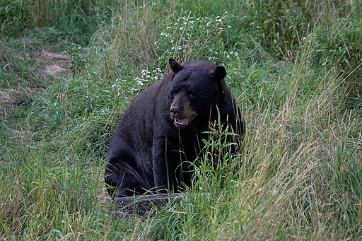
Some Bears View the Friendly Skies

Environmental & Science Education
Edward Hessler

Black bear2
By dalliedee (http://www.flickr.com/photos/dalliedee/2993576282/)
[CC BY 2.0 (http://creativecommons.org/licenses/by/2.0)],
via Wikimedia Commons
On August 13, I heard an interview by Dan Gunderson (Minnesota Public Radio) with bear researcher Mark Ditmer. Ditmer has been tracking radio-collared bears for years in northwest Minnesota. He has found no evidence that the bears have been bothered by it (based on heart-rate data).

However, when Ditmer used drones to monitor bear behavior (video camera), the bears showed  noticeable changes. Their heart rates spiked dropping only when the drones left the area. The heart rate of one bear, a mother with cubs, went from 41 heartbeats/minute to 162 heartbeats/minute. dropping only when the drones left the area. One bear ran away, moving faster than it ever had. Another bear changed its home range, moving about 7.5 km (and into another bear's home range). These bears were quite familiar with the noise of machinery from motor vehicles and farm equipment.

It is a small study--4 bears and 17 flights (at a height of about 20 m) but these findings certainly indicate the need for additional research since drones are increasingly used in conservation biology to study and monitor ecosystems. 

Gunderson's interview may be heard here. Additionally, these findings have been published in Current Biology.

Wednesday, August 12, 2015

Fort Simpson to Inuvik: 900 miles of paddling

 WATER & WATERSHEDS
by Taylor Fredin and Nick Peterson

Deh Cho Canoe Expedition

Taylor Fredin and Nick Peterson are paddling 1,500 miles across the Mackenzie River watershed.  The canoe trip will take them down the Slave River, around the South Shore of Great Slave Lake, and down Canada’s longest river: the Mackenzie.  They will be exploring northern culture and environmental issues in and around the watershed.

Fort Simpson to Norman Wells: July 7- July 16

Nahanni Mountains 
This section of our trip was characterized by beautiful mountains, excellent wildlife viewing, and fast paddling.

A few days after leaving Fort Simpson, Taylor and I rounded Camsell Bend, the point where the Mackenzie begins flowing almost due North.  Here, with the smoky fires behind us, we could see the Nahanni and Camsell mountain ranges.  As two Midwest "flatlanders" we were awed by the incredible scenery.  The mountainous scenery continued all the way to Norman Wells.


On July 14, 36 days into our trip, we awoke at 2:45 am to the sound of plastic hitting rock.  "Is that the bear barrel?" Taylor said.  I poked my head out of the tent to look around.  Sure enough, the smallest of our three bear barrels was lying on the ground.  A moment later a black bear sauntered past the tent.  Only 20 feet away!  Taylor yelled at the bear, while I fumbled with the camera and failed to get a photo.  The bear left camp.  An approaching storm and a stiff north wind made leaving camp an unappealing choice.  We opted to stay.  We sang a very loud version of "Big Rock Candy Mountain", hoping that our mediocre singing voices would keep the bear away.  The next morning, from our canoe, we saw another black bear, a moose, and a lynx.  We dubbed the day our wildlife safari.

Two days later we reached Norman Wells.  This marked the beginning of the last section of our journey across the Northwest Territories.

Hike to the top of Bear Rock near Norman Wells

Norman Wells to Inuvik: July 17- August 1

Cooking at the Arctic Circle
We stayed in Norman Wells a day longer than planned because of a strong north wind. As we left town, we passed several oils wells on the river nearby and paddled through a sheen of oil covering the Mackenzie.  We decide to drink water from tributaries for the rest of the trip.

Strong wind and slow current make paddling difficult for the next week. We finally had calm for a few hours as we entered The Ramparts- an area where the river narrows from 3 miles across to a quarter mile. The Ramparts are lined by 100 foot sandstone cliffs where Peregrine Falcons nest.


Entering the Ramparts


After The Ramparts the wind died down a bit. We paddled with another couple from Alberta for a few days. 30 miles from Tsiigehtchic we stopped at Danny Andre's fish camp. He shared home made dry fish strips. He makes dry fish in August and September, netting 40 whitefish a day. The fish is cut into thin strips, smoked and dried. The end result is a fish jerky that is very tasty. We are treated to muskeg (labrador) tea and deep-fried fish and bannock doughnuts for dinner.

Drying Fish

After Tsiigehtchic, we entered the Mackenzie delta. The current slows significantly and the river splits into small channels. We moved slowly, watching for wildlife. We reached Inuvik in the late afternoon. It is bittersweet, as we only have 110 miles left to paddle to get to Tuktoyaktuk.

Fry Bread!